
Drives California The Eastern Sierra
Highway 190: Death Valley
CA 190, Death Valley Scenic Byway · Panamint Springs → Furnace Creek

The drive
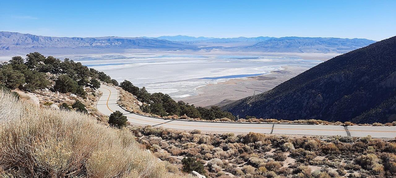
Highway 190 is the main road across Death Valley National Park, and this stretch crosses from the Panamint Valley into Death Valley itself. From Panamint Springs, on the west side of the Panamint Range, it climbs to Towne Pass at 4,956 feet, then drops more than 5,000 feet in one long descent toward the floor of Death Valley, with the valley spread out ahead.
At the bottom is Stovepipe Wells Village, with a gas station that's open 24 hours, and just east of it the Mesquite Flat Sand Dunes, named for the mesquite trees that twist up through the sand; the dunes are at their best at sunrise and sunset, when the ripples throw long shadows. The road then crosses below sea level and runs south down the valley to Furnace Creek, the park's main hub, with its visitor center, inn and ranch.
It's driven west to east, the way drivers from Los Angeles and the Eastern Sierra arrive.
Along the way
- Panamint Springs
- Towne Pass
- Stovepipe Wells
- Furnace Creek
Good to know
- There's a park entrance fee per vehicle, paid by card or online, with self-pay machines at Stovepipe Wells and Furnace Creek; no cash.
- Summer highs can reach 130 degrees: carry plenty of water, and don't hike the low country after 10 a.m. in summer.
- Shift to a low gear on the long descent from Towne Pass; most deaths in the park are single-vehicle rollovers.
- Cell service is limited to nonexistent in much of the park. Fuel is sold at Panamint Springs, Stovepipe Wells and Furnace Creek.
Open all year, weather permitting. Roads close for snow, fire, storms and repairs: before you set off, check National Park Service: Death Valley conditions.
Questions about this drive
How long does Highway 190 take from Panamint Springs to Furnace Creek?
Highway 190 from Panamint Springs over Towne Pass to Furnace Creek is 53.7 miles and takes about 1 hour 10 minutes without stops.
Is there a fee to drive Highway 190 through Death Valley?
Yes. Death Valley National Park charges an entrance fee per vehicle, valid for seven days; pay online or by card at Stovepipe Wells or Furnace Creek.
How high is Towne Pass on Highway 190?
Towne Pass, the high point of Highway 190 between Panamint Springs and Death Valley, is 4,956 feet, and the road drops more than 5,000 feet from it to the valley floor.
Is there gas on Highway 190 in Death Valley?
Yes. Along Highway 190 you can buy fuel at Panamint Springs, Stovepipe Wells, where the station is open 24 hours, and Furnace Creek.
When is the best time to drive Highway 190 in Death Valley?
Winter and spring are mild in Death Valley; in summer, highs along Highway 190 on the valley floor can reach 130 degrees, so carry water and plan for the heat.
What you get in the app
Free on iPhone and Android. CarPlay and Android Auto come with Apex.
More drives near here



Distance, time, elevation, curves and intensity are from Carve's route. Checked 2026-10-28.