Drives Texas Big Bend and West Texas
Scenic Drive, El Paso
Scenic Drive · Rim Road → Alabama Street

The drive
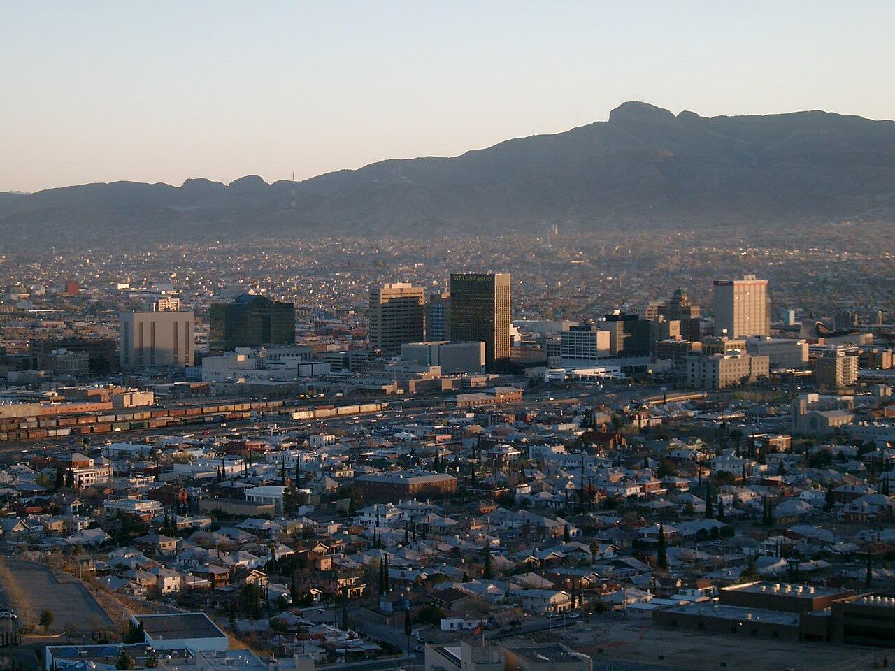
Scenic Drive is El Paso's balcony. It's a short, winding road cut into the south face of the Franklin Mountains, finished in 1920, with big houses on the uphill side and the whole city on the other. It runs from Rim Road east to Alabama Street, about 500 feet above the Rio Grande.
Partway along is Murchison Rogers Park, a small rocky overlook where you can pull over and look across downtown El Paso, Ciudad Juárez and the Chihuahuan desert beyond. The drive itself is over in a few minutes; the overlook is where people spend their time.
The road is narrow and the bends are tight, so it's a slow drive rather than a fast one. It's also a local walking and running route.
Along the way
- Rim Road
- Murchison Rogers Park
- Alabama Street
Good to know
- The city closes part of Scenic Drive, between Wheeling and Robinson, to cars on Sunday mornings for Scenic Sundays, when it's open to walkers, runners and cyclists.
- Expect people on foot and parked cars near the overlook, where parking is tight on weekends.
- The road is narrow and twisty; take it slowly.
Open all year, weather permitting. Roads close for snow, fire, storms and repairs: before you set off, check City of El Paso Parks and Recreation.
Questions about this drive
How long is Scenic Drive in El Paso?
Scenic Drive from Rim Road to Alabama Street is 1.6 miles and takes about 5 minutes without stopping. Most of the time people spend there is at the Murchison Rogers Park overlook.
Is Scenic Drive in El Paso closed on Sundays?
Yes, part of it. On Sunday mornings the city closes Scenic Drive between Wheeling and Robinson to cars for Scenic Sundays, so walkers, runners and cyclists can use it.
What can you see from Scenic Drive?
From the Murchison Rogers Park overlook on Scenic Drive you look across downtown El Paso, Ciudad Juárez and the Chihuahuan desert, about 500 feet above the Rio Grande.
When was Scenic Drive built?
The city approved Scenic Drive in 1920 and finished it that October; it was paved and widened in 1932.
What you get in the app
Free on iPhone and Android. CarPlay and Android Auto come with Apex.
More drives near here



Distance, time, elevation, curves and intensity are from Carve's route. Checked 2026-10-28.