Drives South Carolina North Georgia and the Upstate
Caesars Head: US 276
US 276, Geer Highway · Travelers Rest → Near the North Carolina line

The drive
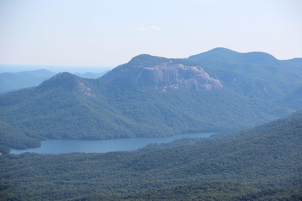
US 276 starts at Travelers Rest and climbs the Blue Ridge Escarpment to Caesars Head State Park, at 3,208 feet. The park's overlook, easy to reach from the road, looks back toward Greenville and extends into North Carolina and Georgia.
The park is part of the Mountain Bridge Wilderness Area. Nearby are Devil's Kitchen, a rocky gap just wide enough for one person, and the trail to Raven Cliff Falls, a 420-foot cascading waterfall.
Hurricane Helene damaged US 276 near Caesars Head; SCDOT repaired a washout and installed guardrails. The drive ends a short way below the North Carolina line; the highway continues into North Carolina.
Along the way
- Travelers Rest
- Caesars Head State Park
- Near the North Carolina line
Good to know
- Parking at Caesars Head State Park is limited and first-come, first-served, and there is no roadside parking.
- The park is open 9 a.m. to 6 p.m., extended to sunset during Daylight Saving Time, and there is a small trail-access fee.
- Thousands of hawks migrate through the park each fall, from September 1 to November 30.
Open all year, weather permitting. Roads close for snow, fire, storms and repairs: before you set off, check SC 511.
Questions about this drive
How long does the Caesars Head drive on US 276 take?
Travelers Rest to the area near the North Carolina line on US 276 is 24.1 miles and takes about 40 min without stops.
Is US 276 at Caesars Head open after Hurricane Helene?
Yes. SCDOT repaired the Helene washout near Caesars Head. Check SC 511 for current conditions.
How high is Caesars Head?
Caesars Head State Park sits at 3,208 feet above sea level, on the Blue Ridge Escarpment.
What you get in the app
Free on iPhone and Android. CarPlay and Android Auto come with Apex.
More drives near here



Distance, time, elevation, curves and intensity are from Carve's route. Checked 2026-10-28.