Drives California The Central Coast
Highway 166: Santa Maria to New Cuyama
CA 166 · Santa Maria → New Cuyama

The drive
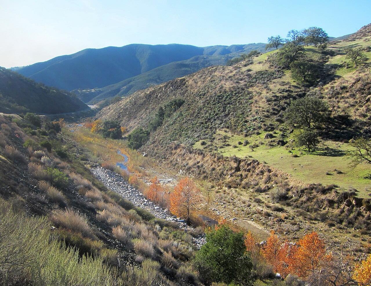
Highway 166 is the quiet way from the Central Coast to the inland valleys. It leaves US 101 at Santa Maria and heads east into a long canyon cut by the Cuyama River, between the Sierra Madre Mountains to the south and the San Luis Obispo County mountains to the north. Along the way it crosses the Santa Barbara and San Luis Obispo county line again and again, five times in all, past cattle ranches and the Russell Ranch oil field.
The canyon finally opens onto the wide, dry Cuyama Valley, with the Caliente Range, home to San Luis Obispo County's highest peak, rising to the north. The drive ends at New Cuyama, a town the Atlantic Richfield Company built in the early 1950s for its oil workers after oil was found at the South Cuyama field; today carrot fields cover much of the valley floor. From here Highway 166 carries on to Highway 33 and Maricopa.
It's driven east from Santa Maria. This is a fast, sweeping two-lane road rather than a twisty one, and the canyon is the reason to take it.
Along the way
- Santa Maria (US 101)
- New Cuyama
Good to know
- Expect big trucks: freight is routed onto Highway 166 rather than the narrower Highway 58.
- Construction can bring one-way traffic control to the Cuyama River stretch; check Caltrans before you go.
- From US 101 to Highway 33 it's the CHP Officers Irvine and Stovall Memorial Highway, named for two officers killed when a 1998 storm washed out part of the road.
Open all year, weather permitting. Roads close for snow, fire, storms and repairs: before you set off, check Caltrans: Highway 166 conditions.
Questions about this drive
How long does Highway 166 take from Santa Maria to New Cuyama?
Highway 166 from US 101 at Santa Maria to New Cuyama is 51.9 miles and takes about 55 minutes without stops.
Is Highway 166 a twisty road?
No. Highway 166 through the Cuyama River canyon is mostly gentle, fast sweepers, a scenic drive rather than a technical one.
Are there trucks on Highway 166?
Yes. Trucks kept off much of Highway 58 are pointed to Highway 166 instead, so expect big rigs on this two-lane road.
What is there to see in New Cuyama?
New Cuyama, at the east end of this drive on Highway 166, is a small former oil company town built in the 1950s, in a valley now farmed largely for carrots.
What you get in the app
Free on iPhone and Android. CarPlay and Android Auto come with Apex.
More drives near here



Distance, time, elevation, curves and intensity are from Carve's route. Checked 2026-10-28.