Drives Texas Big Bend and West Texas
River Road: Lajitas to Presidio
FM 170 · Lajitas → Presidio

The drive
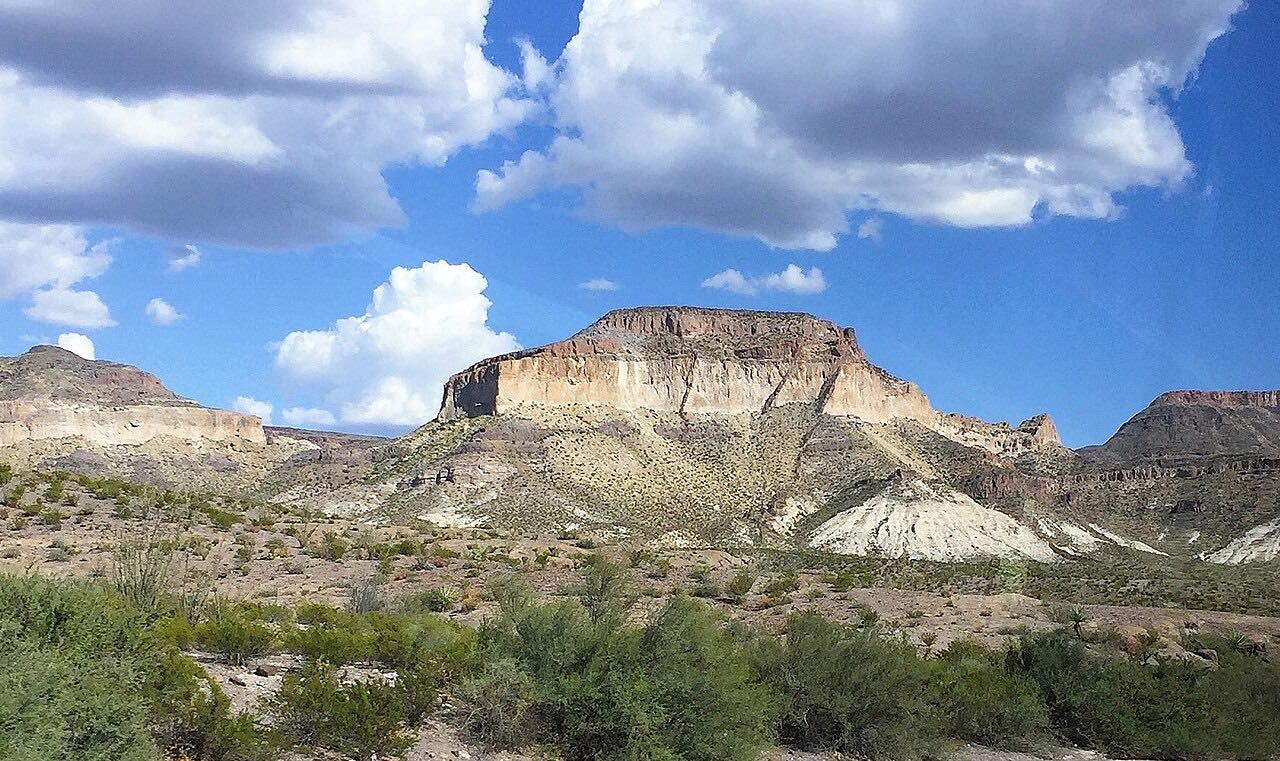
FM 170, the River Road or Camino del Rio, follows the Rio Grande upstream from Lajitas to Presidio along the southern edge of Big Bend Ranch State Park, at 311,000 acres the largest state park in Texas. Mexico is just across the river.
Heading west from Lajitas, the road is at its most dramatic: mountainous, with sharp curves and steep grades as it climbs over ridges and drops back toward the river. Farther on it turns briefly away from the river at Colorado Canyon, the only Big Bend canyon carved from volcanic rock, then opens out past the farming village of Redford toward Presidio.
There are river access points along the way for floating, fishing and hiking, and the drive ends at Presidio near Fort Leaton State Historic Site, the park's west entrance.
Along the way
- Lajitas
- Presidio
Good to know
- Services along the road are scarce; fill up in Lajitas, Terlingua or Presidio.
- Big Bend Ranch State Park has a daily entry fee. The Barton Warnock Visitor Center at the Lajitas end and Fort Leaton near Presidio sell passes and permits, and both are open daily.
Open all year, weather permitting. Roads close for snow, fire, storms and repairs: before you set off, check TxDOT DriveTexas.
Questions about this drive
How long does the River Road from Lajitas to Presidio take?
FM 170 from Lajitas to Presidio is 47.8 miles and takes about 1 hour 20 minutes without stops; the curves and grades keep speeds down.
Is the River Road in Big Bend steep?
In places. FM 170 between Lajitas and Presidio is mountainous, with sharp curves and steep grades as it climbs over ridges above the Rio Grande.
Is FM 170 open?
Usually. The Lajitas to Presidio section is the drive, though flooding has closed FM 170 upstream of Presidio toward Ruidosa before. Check TxDOT's DriveTexas map before going.
Is there a fee to drive the River Road?
No. FM 170 is a state highway with no toll. Big Bend Ranch State Park, along the road, has its own daily entry fee for its sites.
What you get in the app
Free on iPhone and Android. CarPlay and Android Auto come with Apex.
More drives near here



Distance, time, elevation, curves and intensity are from Carve's route. Checked 2026-10-28.