Drives Alberta Banff, Jasper and the Canadian Rockies
Elbow Valley: Highway 66
Kananaskis Country, Alberta · Bragg Creek → Little Elbow

The drive
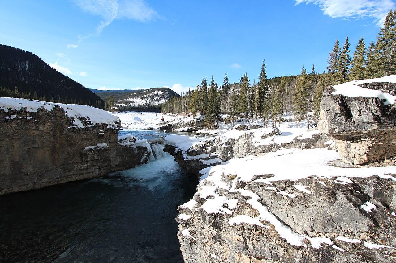
Highway 66 leaves Highway 22 at Bragg Creek and follows the Elbow River into the Kananaskis front ranges. The drive is 17.3 miles in about 20 minutes, leisurely with mostly gentle curves, and passes Elbow Falls, where a short, mostly paved trail with several sets of stairs leads to multiple viewpoints.
It ends at Little Elbow. West of Elbow Falls, Highway 66 closes every year from December 1 to May 14. The Elbow Falls parking lot is large, with vault toilets, and also serves trailheads for Prairie Mountain, Elbow Valley, Prairie Creek and Powderface Creek.
Along the way
- Bragg Creek (Highway 22)
- Elbow Falls
- Little Elbow
Good to know
- A Kananaskis Conservation Pass is required to park in Kananaskis.
- West of Elbow Falls, the highway is closed from December 1 to May 14.
West of Elbow Falls closed every December 1 to May 14. Roads close for snow, fire, storms and repairs: before you set off, check Alberta Parks: Kananaskis annual road closures.
Questions about this drive
How long is Highway 66 to Elbow Falls?
The full drive from Bragg Creek to Little Elbow is 17.3 miles and takes about 20 minutes.
Is Highway 66 open in winter?
Highway 66 is closed west of Elbow Falls every December 1 to May 14.
Do I need a pass to park at Elbow Falls?
Yes: a Kananaskis Conservation Pass is required to park in Kananaskis.
What you get in the app
Free on iPhone and Android. CarPlay and Android Auto come with Apex.
More drives near here


Distance, time, elevation, curves and intensity are from Carve's route. Checked 2026-10-28.