Drives Texas The Texas Panhandle and the Caprock
Highway 86: Silverton to Turkey
TX 86 · Silverton → Turkey

The drive
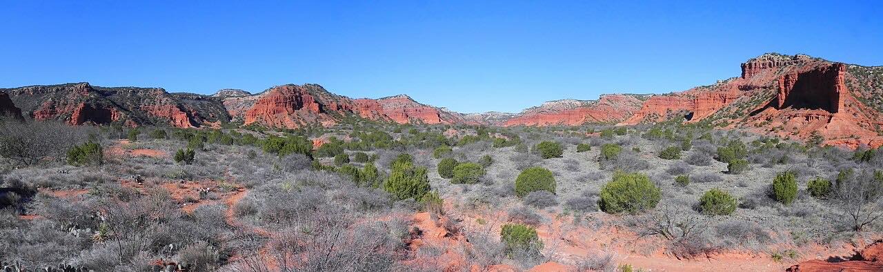
Highway 86 picks up where the Highway 207 drive ends. It leaves Silverton and heads east across the flat top of the High Plains, then drops in one long descent off the Caprock escarpment into the broken red country below.
At the bottom is Quitaque, the town for Caprock Canyons State Park, where the Texas State Bison Herd roams the canyon plains and the Caprock Canyons Trailway leads out to Clarity Tunnel, where bats roost in the warmer months. From Quitaque the road carries on through red breaks and ranch land to Turkey.
Turkey is the hometown of Bob Wills, the King of Western Swing. The Bob Wills Museum is in town, and Bob Wills Day, held each spring on the last Saturday in April, fills the place with fiddlers and dancers.
Along the way
- Silverton
- Quitaque
- Turkey
Good to know
- The descent off the Caprock is the one real grade; otherwise it's a straight, quiet two-lane.
- Caprock Canyons State Park charges a daily entry fee; the park office is in Quitaque.
- The bison in Caprock Canyons are wild animals; give them plenty of room.
Open all year, weather permitting. Roads close for snow, fire, storms and repairs: before you set off, check TxDOT DriveTexas.
Questions about this drive
How long is Highway 86 from Silverton to Turkey?
Highway 86 from Silverton through Quitaque to Turkey is 25 miles and takes about 25 minutes without stops.
How do you get to Caprock Canyons State Park?
Caprock Canyons State Park is reached from Quitaque, on Highway 86 below the Caprock between Silverton and Turkey.
Can you see bison at Caprock Canyons?
Yes. The Texas State Bison Herd roams the plains of Caprock Canyons State Park, near Quitaque on Highway 86.
What is Turkey, Texas known for?
Turkey, at the east end of this Highway 86 drive, is Bob Wills' hometown, with the Bob Wills Museum and Bob Wills Day each April.
What you get in the app
Free on iPhone and Android. CarPlay and Android Auto come with Apex.
More drives near here


Distance, time, elevation, curves and intensity are from Carve's route. Checked 2026-10-28.