Drives Washington The Columbia Gorge
Highway 142: Lyle to Goldendale
WA 142 · Lyle → Goldendale

The drive
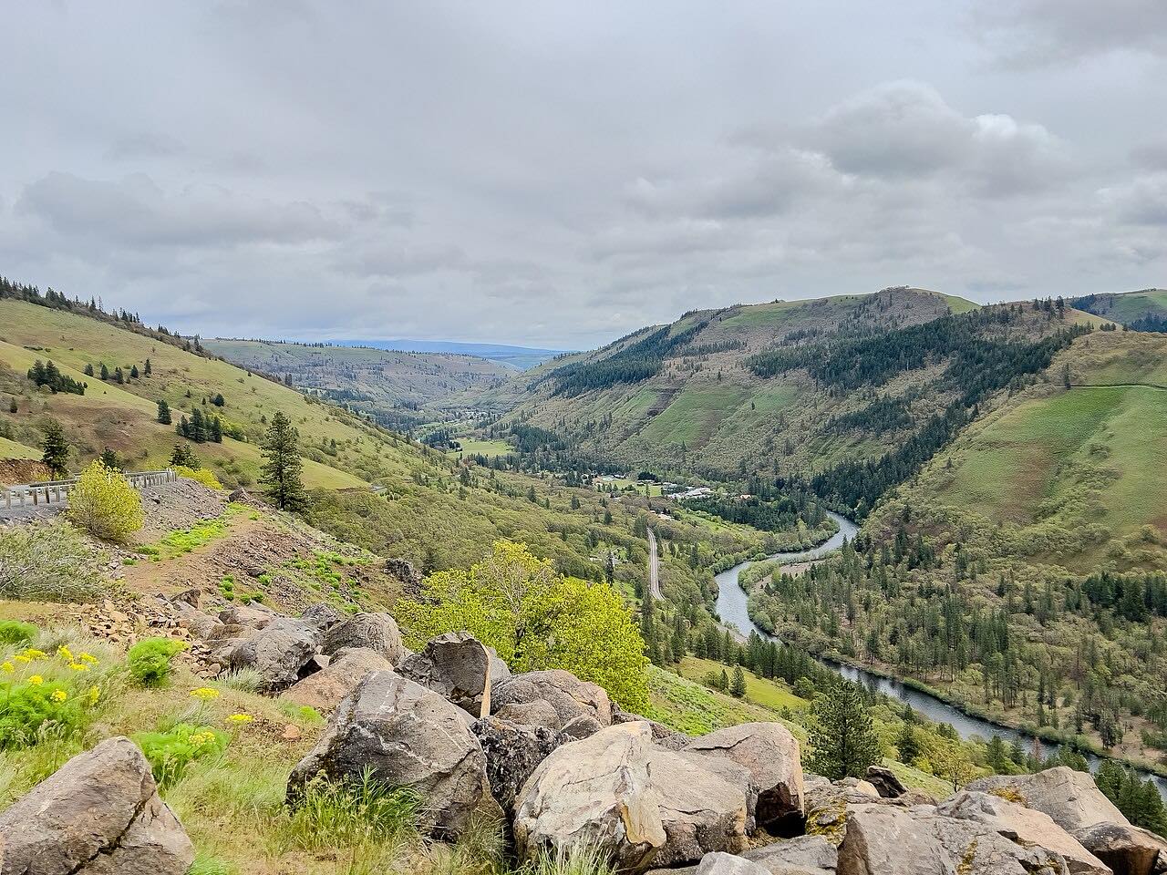
State Route 142 starts at Highway 14 in Lyle and follows the Klickitat River northeast to Goldendale. This drive is 34.2 miles and takes about 1 hr 15 min. Klickitat County built the road in the mid-1930s to link Lyle with the county seat.
It runs through an oak and pine canyon beside the river, passes the town of Klickitat, then climbs onto the Goldendale plateau. The old railroad grade beside the river is now the Klickitat Trail. The road crosses the river on two bridges that meet on a small island when the river runs high.
Traffic is light and the bends are steady. It continues the Highway 14 drive from Lyle for those coming up the Gorge from Portland.
Along the way
- Lyle (Highway 14)
- Klickitat
- Goldendale
Good to know
- Traffic is light.
- The Klickitat Trail runs beside the river, so expect trail users at some pullouts.
- Check WSDOT before a winter trip, since the road climbs onto the plateau.
Open all year, weather permitting. Roads close for snow, fire, storms and repairs: before you set off, check WSDOT: travel alerts and conditions.
Questions about this drive
How long does Highway 142 from Lyle to Goldendale take?
State Route 142 from Lyle to Goldendale is 34.2 miles and takes about 1 hr 15 min.
What river does Highway 142 follow?
State Route 142 follows the Klickitat River from Lyle on the Columbia.
Is Highway 142 busy?
No. It is a quiet two-lane with little traffic.
Is there a trail beside Highway 142?
Yes. The Klickitat Trail follows the old rail corridor along the river between Lyle and Goldendale.
What you get in the app
Free on iPhone and Android. CarPlay and Android Auto come with Apex.
More drives near here


Distance, time, elevation, curves and intensity are from Carve's route. Checked 2026-10-28.