Drives Texas Big Bend and West Texas
US-62/180: Guadalupe Mountains
US 62, US 180 · Salt Flat → New Mexico line

The drive
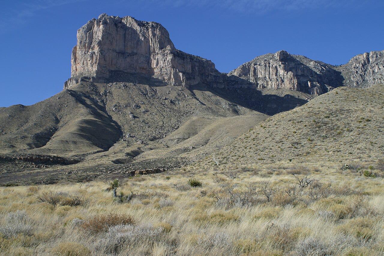
US 62/180 is the only highway through the Guadalupe Mountains, and from the west it puts on a slow reveal. East of Salt Flat the road crosses the salt flats at the foot of the range, which can flood into a shallow lake after summer storms, while the cliff of El Capitan grows ahead and Guadalupe Peak, the highest point in Texas at 8,751 feet, rises behind it.
The road passes the southern face of the peak to Pine Springs, the headquarters of Guadalupe Mountains National Park, with its visitor center. The park protects the world's most extensive Permian fossil reef and eight of the ten highest peaks in Texas; Guadalupe Peak's summit trail is a strenuous 8.4-mile round trip.
From Pine Springs the highway winds over Guadalupe Pass and descends to the New Mexico line, on toward Whites City and Carlsbad.
Along the way
- Salt Flat
- Pine Springs
- New Mexico line
Good to know
- There's no gas in the park and none for 35 miles either way from the visitor center; fill up in El Paso, Van Horn or Whites City.
- The speed limit is 75 mph on the open stretches, lower through Guadalupe Pass.
- The national park charges a per-person entrance fee for its trails and sites, and has no lodges, restaurants or stores; bring food and water.
- The park can reach capacity in spring and fall, its busiest seasons.
Open all year, weather permitting. Roads close for snow, fire, storms and repairs: before you set off, check National Park Service: Guadalupe Mountains conditions.
Questions about this drive
How long is the drive through the Guadalupe Mountains on US 62/180?
US 62/180 from Salt Flat past Pine Springs to the New Mexico line is 42 miles and takes about 35 minutes without stops.
Is there gas at Guadalupe Mountains National Park?
No. There's no gas in the park or for 35 miles in either direction from the Pine Springs visitor center on US 62/180.
Can you see Guadalupe Peak from the highway?
Yes. US 62/180 passes the southern face of Guadalupe Peak, the highest point in Texas, with El Capitan's cliff in front of it.
How far is Guadalupe Mountains from El Paso?
The Pine Springs visitor center is about 110 miles east of El Paso on US 62/180.
What you get in the app
Free on iPhone and Android. CarPlay and Android Auto come with Apex.
More drives near here


Distance, time, elevation, curves and intensity are from Carve's route. Checked 2026-10-28.