Drives Washington The North Cascades
North Cascades Highway
WA 20, North Cascades Highway · Marblemount → Mazama

The drive
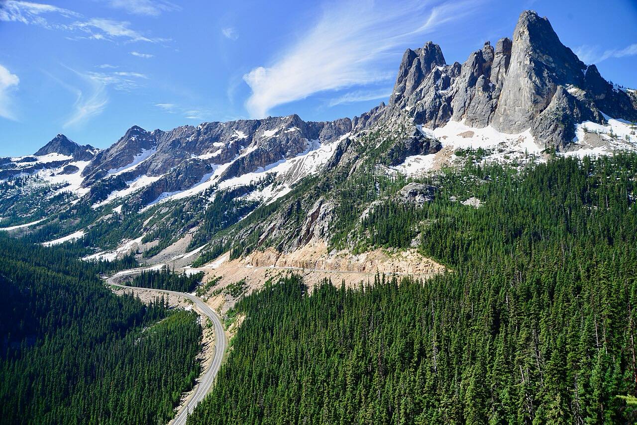
North Cascades Highway is State Route 20, the northern route across the Cascades. It leaves Marblemount on the Skagit River, passes through North Cascades National Park near Newhalem and Diablo Lake, and climbs to Rainy Pass at 4,855 feet and Washington Pass at 5,477 feet before dropping toward the Methow Valley and Mazama.
The Diablo Lake Overlook is the first big stop, with the reservoir below and the peaks behind it. From there the road gains height steadily and is mostly gentle curves. Past Washington Pass it descends in a long set of hairpins below the spires of Liberty Bell Mountain.
It is 73.5 miles and takes about 1 hour 35 minutes with no stops, but most people take much longer, since the overlooks and trailheads are the reason to come.
Along the way
- Marblemount
- Diablo Lake Overlook
- Washington Pass
- Mazama
Good to know
- The highway closes for winter between about milepost 134 (Ross Dam trailhead) and milepost 171 (Silver Star gate) and usually closes in November.
- Services are few and far between east of Marblemount, so fill the tank and carry what you need before you leave.
Closed by snow between Ross Dam and the Silver Star gate near Mazama from about late November to late April or May. Roads close for snow, fire, storms and repairs: before you set off, check North Cascades National Park: conditions.
Questions about this drive
How long does the North Cascades Highway take?
Marblemount to Mazama on Highway 20 is 73.5 miles and takes about 1 hour 35 minutes without stops, with a high point near 5,500 feet.
When is the North Cascades Highway closed for winter?
Highway 20 closes between about milepost 134 and milepost 171 when snow makes it unsafe, usually in November, and typically reopens in late April or May. Floods and slides can delay the reopening.
Is there gas on the North Cascades Highway?
Services are limited between Marblemount and the Methow Valley. Fill up before you start the drive.
Is the North Cascades Highway twisty?
It is mostly gentle curves, with the tightest bends in the hairpins coming down from Washington Pass toward Mazama.
What you get in the app
Free on iPhone and Android. CarPlay and Android Auto come with Apex.
More drives near here


Distance, time, elevation, curves and intensity are from Carve's route. Checked 2026-10-28.