Drives Washington The North Cascades
Mount Baker Highway
WA 542, Mount Baker Highway · Glacier → Artist Point

The drive
Mount Baker Highway is State Route 542, a dead-end road that climbs from the town of Glacier into the Mount Baker-Snoqualmie National Forest and is a designated National Forest Scenic Byway. It runs between 10,778-foot Mount Baker and 9,038-foot Mount Shuksan and ends at Artist Point, near 5,100 feet.
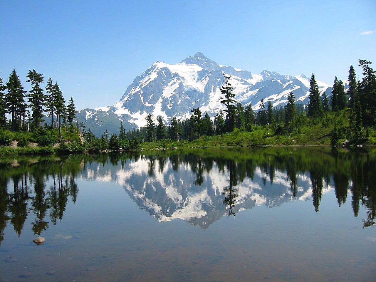
From Glacier the highway rolls through forest, then climbs in switchbacks to the Heather Meadows area. Picture Lake comes near the top, and the reflection of Mount Shuksan in its water is one of the most photographed mountain scenes in the state. The last stretch to Artist Point is narrow, with sharp curves and steep drop-offs, and it is the part that closes for winter.
The route is about 24 miles and takes around 50 minutes without stops. Plan on more: the pullouts and short walks near Picture Lake are the point of the drive.
Along the way
- Glacier
- Picture Lake
- Artist Point
Good to know
- The road to Artist Point closes for the season each fall, usually between about October 15 and November 1, and reopens in June or July after plowing.
- A Northwest Forest Pass or other federal recreation pass is needed to park at Heather Meadows and Artist Point; the Washington Discover Pass is not accepted at these federal sites.
- The final miles are narrow with sharp curves and steep slopes, so drive them slowly and expect to meet oncoming traffic close to the edge.
- It is a dead end, so you come back the way you went up.
Heather Meadows to Artist Point closed by snow from about mid-October until late June or July; open all year to Heather Meadows. Roads close for snow, fire, storms and repairs: before you set off, check WSDOT: Mount Baker Highway (SR 542) pass report.
Questions about this drive
How long does the Mount Baker Highway to Artist Point take?
Glacier to Artist Point on Highway 542 is 23.7 miles and takes about 50 minutes without stops. The road climbs about 4,800 feet to a high point near 5,100 feet.
When does the Mount Baker Highway close for winter?
The top of Highway 542 to Artist Point closes for the season each fall, typically between October 15 and November 1, and reopens in early summer.
Do I need a pass to park at Artist Point?
Yes. Parking at Artist Point and Heather Meadows on the Mount Baker Highway needs a Northwest Forest Pass or another federal recreation pass.
Where is Picture Lake on the Mount Baker Highway?
Picture Lake is near the top of Highway 542, near Heather Meadows, below Mount Shuksan. A paved path runs along it and the site is open all day.
What you get in the app
Free on iPhone and Android. CarPlay and Android Auto come with Apex.
More drives near here



Distance, time, elevation, curves and intensity are from Carve's route. Checked 2026-10-28.