Drives Oregon The Columbia Gorge
Rowena Crest: Mosier to The Dalles
US 30 · Mosier → The Dalles

The drive
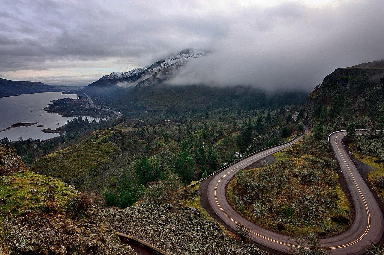
This is the eastern end of the Historic Columbia River Highway. The drive leaves Mosier and heads east through orchards and oak grassland, climbing to the Rowena Crest viewpoint, which looks down on the Rowena Loops. The highway then descends the loops' hairpins to the river and runs into The Dalles.
It's 15.1 miles and about 35 minutes. The Rowena Crest stop sits on the highway beside the viewpoint loop. Footpaths from the crest lead into the Tom McCall Preserve, known for spring wildflowers and plants found only in the Gorge, with the best show in April and May.
Traffic is far lighter than on the western end of the Historic Highway.
Along the way
- Mosier
- Rowena Crest
- The Dalles (West 6th Street)
Good to know
- The preserve's trails have seasonal closures and dogs aren't allowed; check signage at the crest.
- The Rowena Loops are hairpins, so take them slowly.
Open all year, weather permitting. Roads close for snow, fire, storms and repairs: before you set off, check ODOT TripCheck: road conditions.
Questions about this drive
How long is the Rowena Crest drive from Mosier to The Dalles?
Mosier to The Dalles on the Historic Columbia River Highway is 15.1 miles and takes about 35 minutes.
When is the best time to see wildflowers at Rowena Crest?
Spring, especially April and May, when the Tom McCall Preserve is in bloom.
Are the Rowena Loops twisty?
Yes. The loops are a series of hairpins that bring the road down from the crest to river level.
What you get in the app
Free on iPhone and Android. CarPlay and Android Auto come with Apex.
More drives near here


Distance, time, elevation, curves and intensity are from Carve's route. Checked 2026-10-28.