
Drives Fujairah, United Arab Emirates Fujairah, Khor Fakkan and the East Coast
Masafi to Fujairah: Wadi Ham
Sheikh Maktoum Bin Rashid Al Maktoum Road, E89 · Masafi → Wadi Ham

The drive
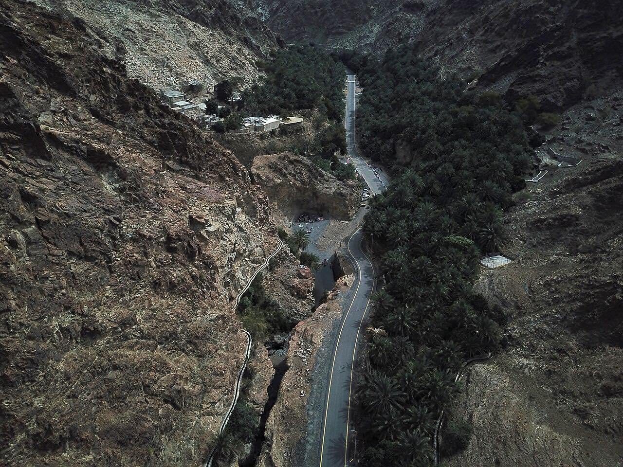
E89 runs from Masafi down the Hajar to the edge of Fujairah, 22 km (14 mi) in about 20 minutes. It is the Sheikh Maktoum Bin Rashid Al Maktoum Road, a divided road that follows the Wadi Ham valley between rock walls on long, easy bends.
Wadi Ham is a seasonal watercourse that runs from Masafi toward Fujairah City until it reaches the Wadi Ham Dam and the Gulf of Oman. Along the road you pass Al Bithnah, a village with a fort that was strategically important. The drive ends at the Fujairah-side roundabout before the city streets, and it connects to the coast roads north to Dibba and Khor Fakkan.
Along the way
- Masafi (E89 south)
- Al Bithnah
- Wadi Ham (Fujairah edge)
Good to know
- Stay on paved roads; sedans should avoid gravel tracks and wadi routes.
- Wadi Ham is a seasonal watercourse: after rain, never cross flooded sections.
- Summer days are very hot; early mornings and the cooler months are more comfortable.
Open all year, weather permitting. Roads close for snow, fire, storms and repairs: before you set off, check Fujairah Tourism and Antiquities Authority.
Questions about this drive
How long does Masafi to Fujairah via Wadi Ham take?
The E89 road from Masafi to the edge of Fujairah is 22 km (14 mi) and takes about 20 minutes.
Is the Wadi Ham road twisty?
No. It is mostly long, gentle bends between rock walls, so the valley is the draw.
What is Al Bithnah on the Masafi to Fujairah road?
Al Bithnah is a village along E89 with a fort that was strategically important.
What you get in the app
Free on iPhone and Android. CarPlay and Android Auto come with Apex.
More drives near here



Distance, time, elevation, curves and intensity are from Carve's route. Checked 2026-10-28.