
Drives California Los Angeles
Little Tujunga Canyon Road
Sand Canyon Road · Sylmar → Sand Canyon Road

The drive
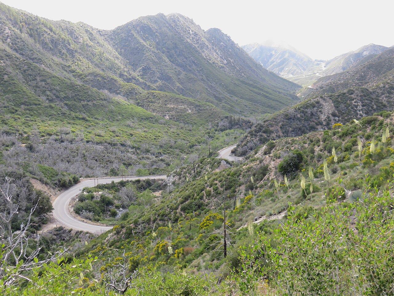
Little Tujunga Canyon Road is the back way from the San Fernando Valley to Santa Clarita. The drive starts in Sylmar and climbs through the Angeles National Forest on a two-lane mountain road, with 2,500 feet of climb over 17 miles and a high point near 2,700 feet at Dillon Divide.
The route goes up Buck Canyon, over the divide and down through Pacoima Canyon into Bear Canyon, with tight curves and cliffside sections for most of the way. There are views of the San Gabriel Mountains and, at Buck Canyon and Pacoima Wash, two old wooden truss bridges. The road ends at the Sand Canyon Road roundabout near Santa Clarita.
Locals know it well, and motorcycles are common on weekends. Almost all of it lies in the national forest, with few homes and no fuel or shops along the way.
Along the way
- Sylmar
- Sand Canyon Road
Good to know
- There are no services along the road; fill up in the valley before you start.
- The road is subject to closure for flooding, mudflows and rockslides, so check county road closures after rain.
- Rocks fall from the cut slopes, and pullouts collect sand and dirt that can end up in the corners.
- Avoid peak commute hours, when the road also serves as a shortcut between the valleys.
Open all year, weather permitting. Roads close for snow, fire, storms and repairs: before you set off, check LA County Public Works: road closures.
Questions about this drive
How long does Little Tujunga Canyon Road take?
Little Tujunga Canyon Road from Sylmar to Sand Canyon Road is 17 miles on this route and takes about 35 minutes.
How twisty is Little Tujunga Canyon Road?
Very. It is twisty most of the way, with tight curves, hairpins and drop-offs, and it climbs about 2,500 feet to a divide near 2,700 feet.
Is there gas on Little Tujunga Canyon Road?
No. The road has no services along it. Fuel up in the San Fernando Valley or Santa Clarita.
Does Little Tujunga Canyon Road close?
It can close for flooding and rockslides, usually after heavy rain. Check the LA County Public Works road closures page before you go.
What you get in the app
Free on iPhone and Android. CarPlay and Android Auto come with Apex.
More drives near here



Distance, time, elevation, curves and intensity are from Carve's route. Checked 2026-10-28.