Drives Prince Edward Island Nova Scotia, New Brunswick and Prince Edward Island
Points East: Souris to St. Peters
Route 16, Northside Road · Souris → St. Peters


The drive
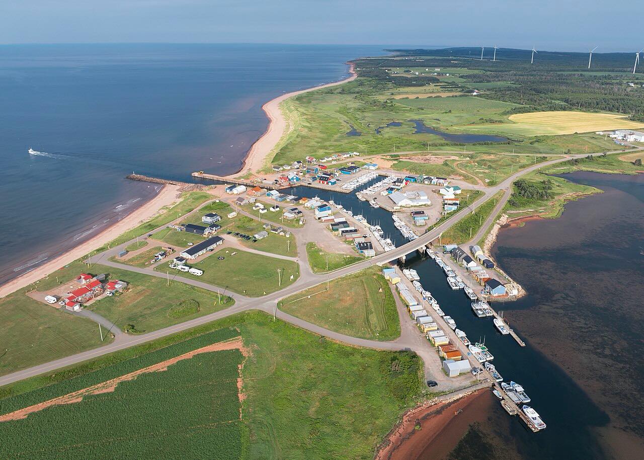
This drive follows Route 16 around the eastern tip of Prince Edward Island, starting at Souris. Basin Head Provincial Park is on Route 16, about 15 minutes from Souris. It is a day-use park with a fisheries museum on a bluff above the Northumberland Strait, and a white-sand beach nicknamed the Singing Sands.
The route reaches East Point Lighthouse, where the Gulf of St. Lawrence meets the Northumberland Strait, then turns west along the north shore. It passes the fishing harbour at North Lake and ends at St. Peters.
The land is flat and open, with the sea in view much of the way.
Along the way
- Souris
- East Point
- North Lake
- St. Peters
Good to know
- Basin Head Provincial Park is open seasonally, from early June to mid-October.
Open all year, weather permitting. Roads close for snow, fire, storms and repairs: before you set off, check PEI 511.
Questions about this drive
How long does the Points East drive on Route 16 take?
Souris to St. Peters is 47.1 miles and takes about 1 hr without stops.
Where are the Singing Sands on Prince Edward Island?
They are at Basin Head Provincial Park, on Route 16 about 15 minutes from Souris. The sand sings underfoot because of its high silica content.
What you get in the app
Free on iPhone and Android. CarPlay and Android Auto come with Apex.
More drives near here
 Ceilidh Trail: Port Hood to MargareeSweeping · Highway 19, Shore Road · 41 mi
 Cape George Scenic Drive: Route 337Sweeping · NS 337, Lakevale Heights Road · 16.7 mi
 Green Gables Shore: Routes 6 and 20Leisurely · Route 6, Route 20 · 25 mi
 Cabot Trail: Chéticamp to Pleasant BaySweeping · Cabot Trail · 26 mi
Distance, time, elevation, curves and intensity are from Carve's route. Checked 2026-10-28.