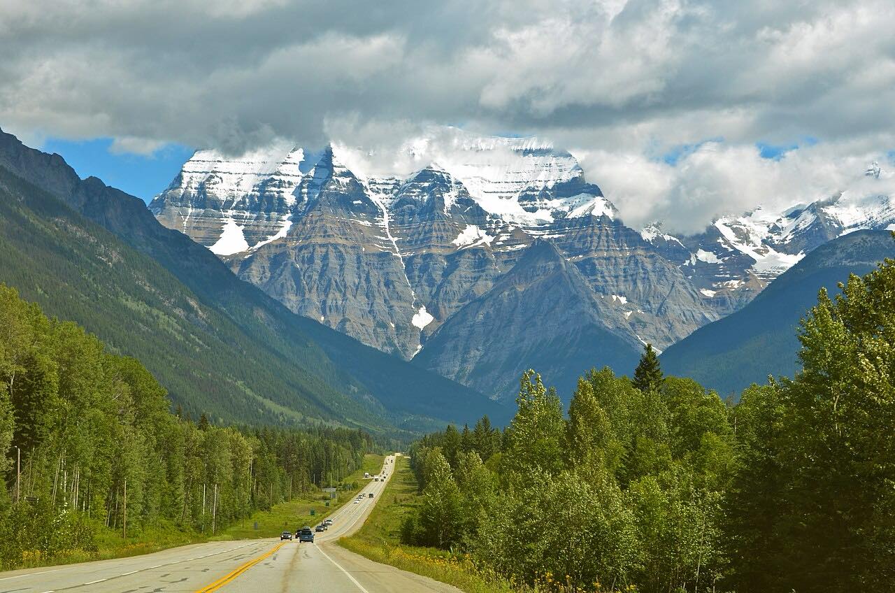
Drives Alberta Banff, Jasper and the Canadian Rockies
Highway 16: Jasper to Mount Robson
Yellowhead Highway, YH 16 · Jasper → Moose Lake

The drive
This is a short run on the Yellowhead Highway, west from the town of Jasper to Moose Lake in Mount Robson Provincial Park. About 9 km out of Jasper the road reaches Yellowhead Pass, which is the Alberta and British Columbia line and also the boundary between Jasper National Park and Mount Robson Provincial Park.
Yellowhead Pass is one of the lowest crossings of the Continental Divide in the northern Rockies, and it was named a National Historic Site of Canada in 1971. It takes its name from Pierre Bostonais, called Tête Jaune, and it was used for centuries by First Nations people and later by fur traders and railway builders. There is a roadside pullout at the pass.
The road itself is a gentle two-lane highway, so the reason to drive it is the mountain scenery and the pass, not the curves. Wildlife is common along the roadway.
Along the way
- Jasper (Highway 16 west)
- Moose Lake (Mount Robson Park)
Good to know
- Jasper National Park has Parks Canada pass requirements, and the rules for passing through on Highway 16 have changed over time; check the Parks Canada page before you go.
- Wildlife is common along the road, so watch for animals on the pavement and for traffic slowing without warning.
- British Columbia requires winter tires on designated highways in the North, generally from October 1 to March 31 and to April 30 on some routes; signs mark them.
Open all year, weather permitting. Roads close for snow, fire, storms and repairs: before you set off, check DriveBC.
Questions about this drive
How long is Highway 16 from Jasper to Mount Robson?
The Highway 16 drive from Jasper to Moose Lake near Mount Robson is 43 miles and takes about 44 minutes without stops.
Where is Yellowhead Pass on Highway 16?
Yellowhead Pass is about 9 km west of Jasper on Highway 16, where the road crosses from Alberta into British Columbia. A roadside pullout marks the national historic site.
Do you need a park pass to drive Highway 16 through Jasper?
Jasper National Park has pass requirements that have included exceptions for through-travel on Highway 16. Check Parks Canada for the current rule before driving.
Is Highway 16 near Jasper open in winter?
Highway 16 is a main year-round highway, and winter tires are required on designated British Columbia highways. Check DriveBC for conditions before you leave.
What you get in the app
Free on iPhone and Android. CarPlay and Android Auto come with Apex.
More drives near here


Distance, time, elevation, curves and intensity are from Carve's route. Checked 2026-10-28.