Drives California Los Angeles
Big Tujunga Canyon Road
San Gabriel Mountains, California · Sunland → Angeles Crest Highway

The drive
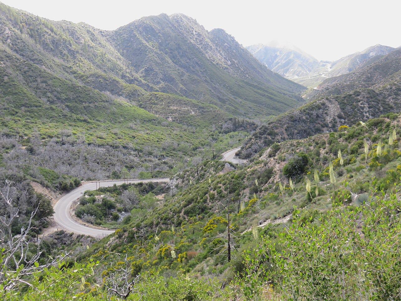
Big Tujunga Canyon Road is the back way from the northeast edge of Los Angeles into the San Gabriel Mountains. From Sunland it climbs into the canyon of Big Tujunga Creek in the Angeles National Forest and soon passes Big Tujunga Dam, a concrete arch dam finished in 1931 and thickened in a seismic retrofit completed in 2011.
Above the dam the road follows the canyon through steep chaparral and rock, the twistiest part of the drive, to Angeles Forest Highway. The route follows Angeles Forest Highway north for about four and a half miles, then turns onto Upper Big Tujunga Canyon Road, which winds on through high, open chaparral country up the upper canyon.
It ends just short of Angeles Crest Highway, between Red Box and Charlton Flats, where it meets the Angeles Crest drive without repeating it.
Along the way
- Sunland
- Upper Big Tujunga Canyon Road
- Angeles Crest Highway
Good to know
- Angeles Forest Highway, which the drive uses for about 4.6 miles, sometimes closes on weekdays for maintenance; check before you go.
- LA County closes these roads ahead of snow and ice in winter and after big storms; check its closure list before going.
- Watch for rockfall, cyclists, and weekend motorcycle traffic.
- There's no public access to Big Tujunga Reservoir behind the dam.
Open all year, weather permitting. Roads close for snow, fire, storms and repairs: before you set off, check LA County Public Works road closures.
Questions about this drive
How long does Big Tujunga Canyon Road take?
Big Tujunga Canyon Road from Sunland to Angeles Crest Highway, by way of Angeles Forest Highway and Upper Big Tujunga Canyon Road, is 25.1 miles and takes about 55 minutes.
Is Big Tujunga Canyon Road open?
LA County lists closures on its Public Works road closure page; it closes Big Tujunga and Upper Big Tujunga Canyon roads for storms, snow and ice, and the Angeles Forest Highway link can close for weekday maintenance.
Where does Upper Big Tujunga Canyon Road go?
Upper Big Tujunga Canyon Road runs from Angeles Forest Highway up the upper canyon to Angeles Crest Highway, between Red Box and Charlton Flats.
When was Big Tujunga Dam built?
Big Tujunga Dam, beside Big Tujunga Canyon Road above Sunland, was finished in 1931 and retrofitted for earthquakes between 2008 and 2011.
What you get in the app
Free on iPhone and Android. CarPlay and Android Auto come with Apex.
More drives near here



Distance, time, elevation, curves and intensity are from Carve's route. Checked 2026-10-28.