Drives Washington Seattle and Puget Sound
Whidbey Island: Highway 20
WA 20, Deception Pass Bridge · Pass Lake → Coupeville

The drive
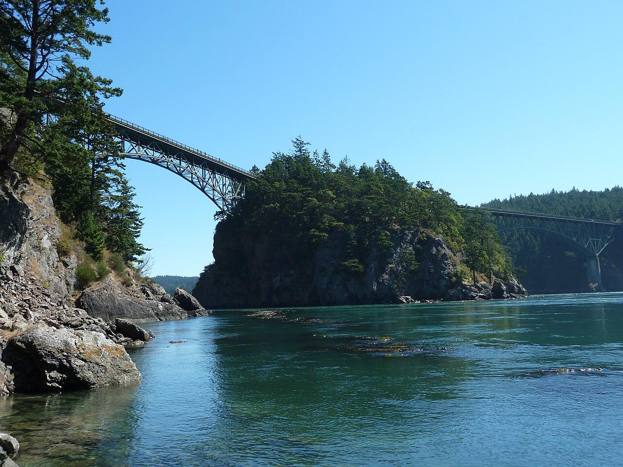
This drive starts at Pass Lake on Fidalgo Island and crosses the Deception Pass Bridge to Whidbey Island. The bridge is really two spans, the Canoe Pass and the main span over Deception Pass, joined across Pass Island. They were completed in 1935, about 180 feet above the tidal channel, with Civilian Conservation Corps workers among the builders.
South of the bridge the highway runs through the forest of Deception Pass State Park, then past Oak Harbor, where it is four lanes with traffic lights, and on through open farmland. It ends in Coupeville on Penn Cove.
The drive is 21 miles and takes about 35 minutes. The road has few bends, so the bridge, the forested pass and Penn Cove are the reasons to come.
Along the way
- Pass Lake (north of Deception Pass)
- Deception Pass Bridge
- Coupeville
Good to know
- Parking for the bridge is in the state park lots at either end, not on the highway.
- Traffic is busy through Oak Harbor, where the highway has four lanes and traffic lights.
Open all year, weather permitting. Roads close for snow, fire, storms and repairs: before you set off, check WSDOT: travel alerts.
Questions about this drive
How long is the Highway 20 drive across Whidbey Island?
Pass Lake to Coupeville on Highway 20 is 21 miles and takes about 35 minutes.
How high is the Deception Pass Bridge?
It is about 180 feet above the water. The bridge was completed in 1935.
Where do you park for Deception Pass Bridge?
Parking is in the Deception Pass State Park lots at either end of the bridge.
What you get in the app
Free on iPhone and Android. CarPlay and Android Auto come with Apex.
More drives near here



Distance, time, elevation, curves and intensity are from Carve's route. Checked 2026-10-28.