Drives Arizona The Grand Canyon and Northern Arizona
Vermilion Cliffs: Highway 89A
89A · Bitter Springs → Jacob Lake

The drive
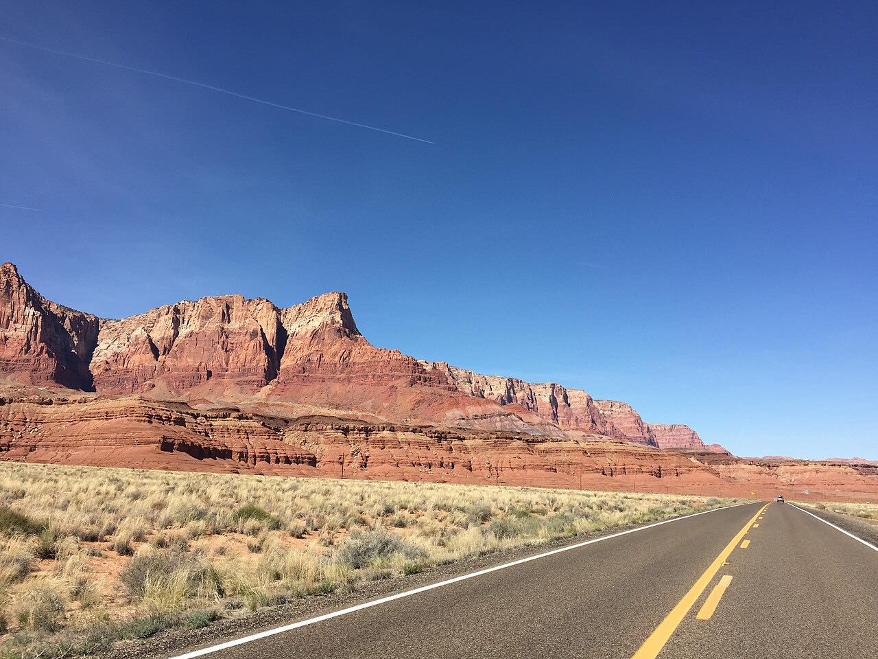
US 89A is the quiet way across northern Arizona. It leaves US 89 at Bitter Springs, below the Echo Cliffs, and runs to Navajo Bridge, where the road crosses the Colorado River at Marble Canyon. Then it turns west along the foot of the Vermilion Cliffs, past Vermilion Cliffs Lodge, through long stretches of open desert with very little in the way of services.
Past the cliffs the road climbs onto the Kaibab Plateau in a run of bends and ends at Jacob Lake, where Highway 67 heads south to the North Rim of the Grand Canyon. Most of the drive is gentle, with one twisty stretch near the top of the climb. It's here for the scale of the country and the river crossing, not for corners.
Along the way
- Bitter Springs (US-89)
- Navajo Bridge
- Vermilion Cliffs Lodge
- Jacob Lake
Good to know
- Services are few and far apart on this road, so fill the tank before Bitter Springs.
- US 89A stays open through the winter, but the climb to Jacob Lake can still see snow.
- Highway 67 from Jacob Lake to the North Rim is closed for the winter, usually from December 1 until about mid-May.
Open all year, weather permitting. Roads close for snow, fire, storms and repairs: before you set off, check Arizona 511 (ADOT).
Questions about this drive
How long does Highway 89A from Bitter Springs to Jacob Lake take?
Highway 89A from Bitter Springs to Jacob Lake is 55 miles and takes about 1 hour.
Is Highway 89A open in winter?
Yes. ADOT has said US 89A remains open through the winter, though the Kaibab Plateau near Jacob Lake can have snow and ice.
Where does Highway 89A cross the Colorado River?
Highway 89A crosses the Colorado River at Navajo Bridge in Marble Canyon, early in the drive from Bitter Springs.
Is the road to the North Rim open year-round?
No. Highway 67, which leaves 89A at Jacob Lake for the North Rim, closes for the winter, usually starting December 1.
What you get in the app
Free on iPhone and Android. CarPlay and Android Auto come with Apex.
More drives near here



Distance, time, elevation, curves and intensity are from Carve's route. Checked 2026-10-28.