Drives California The Southern Sierra
Kern River Canyon: Highway 178
Kern Canyon Road, Isabella Walker Pass Road, CA 178 · Kern Canyon mouth → Lake Isabella

The drive
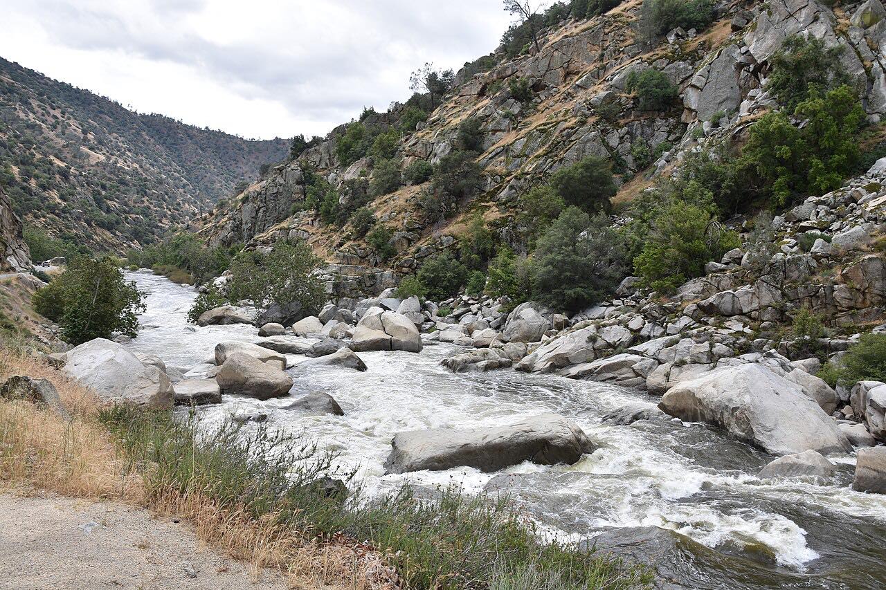
Highway 178 through the Kern River Canyon is the main road from Bakersfield to Lake Isabella, and one of the most dramatic in the southern Sierra. Past the end of the Bakersfield expressway it enters the canyon mouth and becomes a narrow two-lane road, often only 18 to 24 feet wide, cut into the canyon wall beside the river. The rock walls were blasted out with dynamite; the road took nine years to build and opened in 1931.
Heading upstream, it bends sharply around sheer rock faces with steep drops to the water, climbing from about 650 feet at the mouth to around 2,250 feet where the canyon opens out. The drive ends at Lake Isabella, before Highway 178 becomes a short freeway. From there Highway 155 runs up the lake's west shore to Wofford Heights and Greenhorn Summit.
Along the way
- Kern Canyon mouth (Bakersfield)
- Lake Isabella
Good to know
- The posted limit is 55 mph, but the sharp curves keep real speeds well below it; pass only where it's clearly safe.
- The Kern is fast, cold and deadly: signs on Highway 178 count the people who have drowned in it since 1968, and the Kern County Sheriff's Office updates them every year.
- Rockslides and fires close the canyon from time to time. Check Caltrans before going.
Open all year, weather permitting. Roads close for snow, fire, storms and repairs: before you set off, check Caltrans: Highway 178 conditions.
Questions about this drive
How long is the drive through the Kern River Canyon on Highway 178?
Highway 178 from the Kern Canyon mouth at Bakersfield to Lake Isabella is 24.8 miles and takes about 30 minutes.
Is Highway 178 through the Kern Canyon dangerous?
Highway 178 in the Kern Canyon is narrow, with sharp curves around rock faces and steep drops to the river, so take it at a steady pace and pass only where it's clear.
Is Highway 178 through the Kern Canyon open?
Highway 178 through the Kern Canyon is open most of the time, but rockslides and fires close it now and then; Caltrans posts current status.
Can you swim in the Kern River along Highway 178?
The Kern River beside Highway 178 is fast and cold, and signs on the highway count the hundreds of people who have drowned in it since 1968, so the Sheriff's Office urges real caution near the water.
What you get in the app
Free on iPhone and Android. CarPlay and Android Auto come with Apex.
More drives near here


Distance, time, elevation, curves and intensity are from Carve's route. Checked 2026-10-28.