
Drives California Los Angeles
Angeles Forest Highway
Angeles Forest Highway · Highway 14 → Angeles Crest Highway

The drive
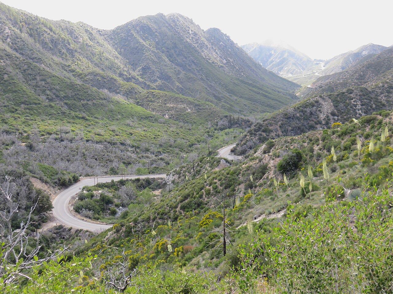
Angeles Forest Highway links the Antelope Valley with the Los Angeles Basin over the San Gabriel Mountains. This drive starts at Highway 14 near Vincent, at Soledad Pass, and runs south into Angeles National Forest, climbing about 2,400 feet from the desert. Mill Creek Summit, at 4,910 feet, is the highest point on the road.
The road passes through Kentucky Springs Canyon, Aliso Canyon and Mill Creek in long, sweeping curves, and ends at Angeles Crest Highway. Los Angeles County maintains it, as County Route N3 and Forest Highway 59, though neither number is posted. It is mostly recreational, but many Antelope Valley commuters use it too.
Along the way
- Highway 14 (Vincent)
- Angeles Crest Highway
Good to know
- The road is known for high-speed crashes; keep to your lane through the curves.
- Los Angeles County has closed the segment between Aliso Canyon Road and Angeles Crest Highway ahead of snow and ice, and reopened it after crews inspect it.
- The Big Tujunga section of the highway is the steepest and the most prone to rockslides.
- County Public Works posts work closures on this road; check the closure list before you go.
Open all year, weather permitting. Roads close for snow, fire, storms and repairs: before you set off, check LA County Public Works: road closures.
Questions about this drive
How long does Angeles Forest Highway take?
Angeles Forest Highway from Highway 14 to Angeles Crest Highway is 17.4 miles and takes about 25 minutes.
Does Angeles Forest Highway close for snow?
It can. Los Angeles County has closed the stretch between Aliso Canyon Road and Angeles Crest Highway ahead of snow and ice, usually reopening after the storm passes and crews inspect the road.
Who maintains Angeles Forest Highway?
Los Angeles County maintains it. It is County Route N3 and Forest Highway 59, though the numbers are not posted on signs.
How high does Angeles Forest Highway climb?
Mill Creek Summit, at 4,910 feet, is its highest point. Soledad Pass, at the Highway 14 end, is 3,220 feet.
What you get in the app
Free on iPhone and Android. CarPlay and Android Auto come with Apex.
More drives near here


Distance, time, elevation, curves and intensity are from Carve's route. Checked 2026-10-28.